14 Dec 2006
With its elevation of 2963 m, the Zugspitze is Germany's highest mountain
(although part of it belongs to Austria - the highest mountain that is completely
inside Germany's borders is the Watzmann).
I had climbed it via the famous Höllental route
three times by then in summer (with my fastest time on this route being 4.5 hours up and 3.5 hours down on 9 Aug 1993),
but this time I was lazy and short of time, so I went up with the cog train and down with the cable car.
Deceived by my experience on mount Wendelstein
of the exceptionally warm weather in the last quarter of 2006, and drawn by the expectation of fantastic views
from the summit of mount Zugspitze, I had set out for some high-elevation hiking, but ended up skiing!
On arrival at the Zugspitzplatt (around 2600 m), I was slightly surprised to find myself in a winter wonderland,
and immediately regretted that I did not bring my skis. Luckily, there is a ski rental,
which asked 24€ for full equipment (but not the latest, which is even more expensive). All right, I accepted the deal,
since the Zugspitzbahn ticket already included the use of the ski lifts.
Surely I was not in great shape for skiing, but as a gentle introduction to this winter's season,
the relatively easy slopes were a perfect fit, and since it was a normal work-day (Thursday), waiting time at the lifts was zero :-)
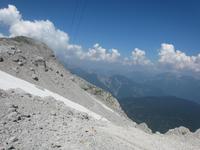
In the early afternoon, I went up to the summit with the small Gletscherbahn cable car to enjoy the panoramic views,
and two hours later I went there again for sunset. This is the only time of the year where the sun sets early enough
before the last Eibseebahn cable car run forces day visitors to leave. As you can see on the pictures below, dusk at the summit was marvellous!
| regular train from Munich, cog train ride from Garmisch
| 
Hörnle
| 
Wetterstein, Ettaler Mandl
| 
Alpspitze
| 
Kramer, cog train
|
|---|

Alpspitze, Zugspitze, Daniel
| 
Mount Daniel
| 
cog railway
| 
4.5 km in an ascending tunnel!
|
| Zugspitzplatt
| 
| 
| 
| 
|
|---|

| 
| 
| 
|

| 
| 
| 
|

| 
| 
Schneefernerhaus
| 
summit
|

| 
| 
| 
|
| summit in the afternoon
| 
summit and Jubiläumsgrat
| 
Münchner Haus
| 
| 
|
|---|

Eibsee
| 
Waxenstein-Riffelwand ridge
| 
Starnberger See, Munich
| 
summit
|

Großvenediger
| 
Habicht
| 
Hoher Kamm
| 
Hochwanner, Hohe Munde
|
| sunset
| 
| 
| 
| 
|
|---|

| 
| 
| 
|

| 
| 
| 
|

| 
| 
| 
|

| 
| 
| 
|

| 
| 
| 
|
| return
| 
Munich
| 
Austrian cable car route
| 
special material transport carriage
| 
train head
|
|---|
21 Jul 2013
After climbing Zugspitze two more times in the meantime (photos to follow here), I went there again, this time for mostly training purposes.
Therefore, I decided for the most direct route, which is from the west (past the border to Austria) and includes an easy secured (via ferrata) section.
Starting from the Ehrwald train station, I took only 3¼ hours for the nearly 2.000 meters of elevation gain, which is a new personal record.
I spent about an hour at the top, where clouds were on and off, before descending the same way.
It was a pretty hot day with some 30°C in the valley, but due to the elevation and a nice breeze, it felt pretty comfortable.
Due to a break at the cosy Wiener-Neustädter Hütte
and wearing just trekking sandals, I did not take much shorter on the way down: a bit over 3 hours.
The GPS track I recorded on my smartphone, which this time for some reason was quite flaky,
is available for download as GPX file or
KML file for Google Earth.
It can be directly viewed
on Google Terrain Maps (including waypoints) and
on GPSies (including waypoints and statistics).
| Ascent to Wiener-Neustädter Hütte
| 
| 
| 
| 
|
|---|

Mount Daniel
| 
close-up
| 
| 
|

| 
| 
| 
|

| 
| 
| 
|

| 
| 
| 
|
| Final ascent
| 
| 
| 
| 
|
|---|

| 
| 
| 
|

| 
| 
| 
|
| At the platform
| 
| 
| 
| 
|
|---|

| 
| 
| 
|

| 
| 
| 
|
| On the actual summit
| 
| 
| 
| 
|
|---|

| 
| 
| 
|
| Back on the platform
| 
| 
| 
| 
|
|---|
| Descent to Wiener-Neustädter Hütte
| 
on the border to Austria
| 
remnants of snow, melting
| 
the very short crux
| 
the 'Stopselzieher'
|
|---|

| 
| 
| 
|
| Descent to Ehrwald
| 
| 
| 
| 
|
|---|

| 
| 
| 
|

| 
| 
| 
|

| 
| 
| 
|

| 
| 
| 
|

Mount Sonnenspitze
| 
close-up
| 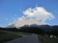
Zugspitze
| 
Ehrwald Zugspitzbahn train station
|
URL: http://David.von-Oheimb.de/gallery/Zugspitze/index.html,
Last modified: Thu Jul 25 00:07:16 CEST 2013