This page is under construction. Several panoramas to be improved and many more photos and some more text to be added ASAP.
Hersonissos
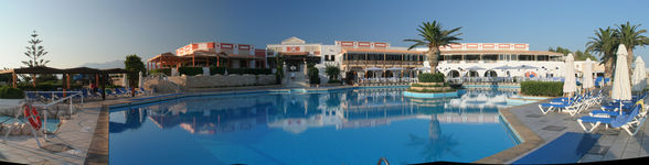
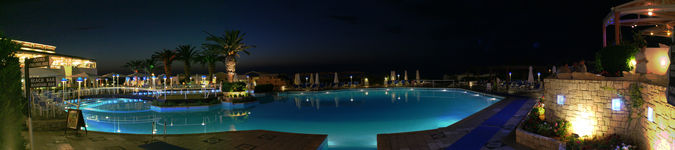
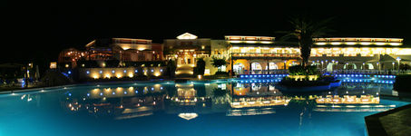
Just some impressions of the Aldemar Knossos Royal Village hotel
a bit east of Heraklion, where the summer school was held.
As one can see from the pictures, the ambiente certainly felt more like summer than like school ;-)
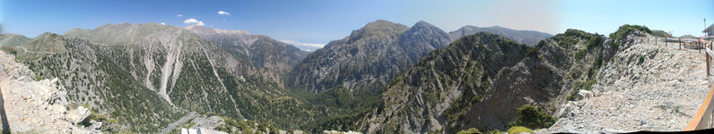
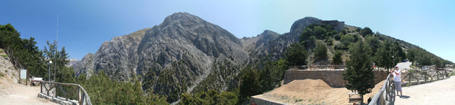
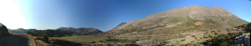
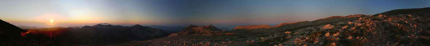
Pachnes
I left the 5-star hotel in Hersonissos at 10:30 AM, transferring to a many-millions-star hotel on Pachnes.
Latest check-in time was darkness, which had to be expected at around 10 PM, so I had to rush.
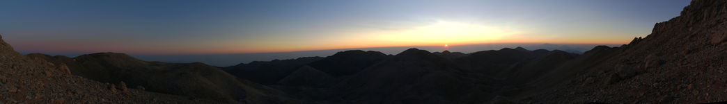
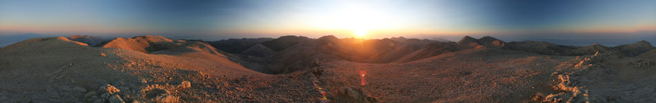
Comfort offered by my rocky bed near the summit was to be improved, so I gladly accepted the wakeup call at dawn.
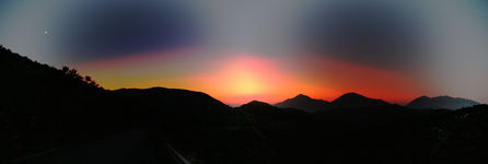
The animation program, with the sun starring, was pretty good and even was for free :-)
As mentioned on the summitpost page,
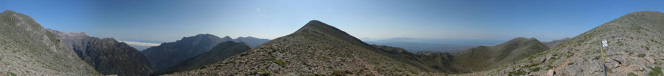
Pachnes is the highest point of the Lefká Óri (White Mountains) range at 2453 m,
and maybe even minimally higher than the officially highest point of Crete: Psiloritis.
Apart from the merit of its elevation and the mood during sunset and sunrise time,
I found the mountain is as uninspiring as most of the other Cretan mountains:
just a worn-down heap of rubble, partially covered with shrubs up to an elevation of about 2000 m.
Views from the top are theoretically very good, but often limited by haze or even fog (i.e., clouds).
Moreover, the mountain base is hard to reach, requiring several extra hours from either side,
where for instance the Western approach is on the E4 hiking trail and includes intermediate drops of some 300 m in total.
Sunrise and sunset can be great from (near) the top, but apart from that, in retrospect I do not consider Pachnes worth climbing.
It most likely would have been more interesting to climb Gingilos,
which is conveniently located right at the upper end of the famous Samaria Gorge.
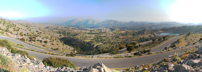
In order to get to the trailhead as quickly as possible, I used a rental car and adopted the local driving style.
It turned out that it is possible to drive from the Omalos plateau an unpaved road with coarse gravel up in the direction of Pachnes,
in particular since by nice coincidence I had got a Fiat Panda 4x4 which had a (nearly) sufficient high clearance.
I suppose that standard cars would also do, though much more care would be needed
in order not to scratch the bottom with loose rocks scattered on the road surface.
I was able to drive about 45 minutes until the road was blocked, reaching about 1500m
and cutting the walking time by at least 2 hours. Still on the way up I took in total (including short breaks)
some 6.5 hours (and 5 hours down the next morning). It could have been at least half an hour less by avoiding
detours, which were due to the fact that while the E4 part of the trail is very well marked and hard to miss,
the opposite holds for the final section towards the South (where there are just occasional cairns).
A pretty bad omission in my view is that not even the turnoff to the summit from the E4 trail is signposted.
Moreover on the Open Cycle Map, which I used at dusk for GPS-assisted navigation, the summit is indicated at the wrong position.
This lead me not to trust the path given on the map, while in fact the path is shown correctly by OSM and actually is optimal
in the sense that it is very direct with almost no ups and downs in between.
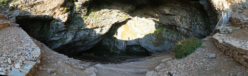
Agia Irini Gorge - Sougia - Samaria Gorge
A friend gave me the very good hint that Agia Irini Gorge, despite being much less famous and not as impressive as
Samaria Gorge, is similarly pleasant to hike.
Even better, both hikes can be combined to a circular trip, though certainly not within a single day.
Between Sougia, which is a few kilometers south of the lower end of Agia Irini (or: Eirini) Gorge and
Agia Roumeli, which is at the bottom of Samaria Gorge, people usually make use of the good (but infrequent)
ferry service, but it is also possible to
hike along the E4 trail,
which must be a great experience, and usually takes some 11 hours.
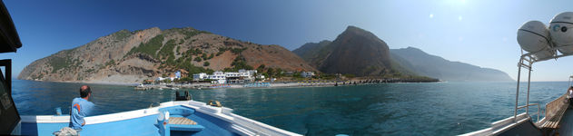
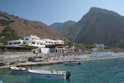
After descending Agia Irini Gorge and reaching Sougia, I spontaneously decided to stay in that charming village not only for the night,
but for an extra day. On the second morning I took the boat to Agia Roumeli, which takes a bit more than an hour,
and then took almost 4.5 hours hiking up Samaria Gorge (while most people prefer hiking down).
I had hoped that I'd get a lift from Omalos back to Agia Irini where I had left the car, but was not lucky with that.
Instead I ended up hiking along the road for some 1.5 hours in the heat of late noon and then finally found a local who was not going in the
direction I needed but accepted my offer to earn 20 Euros for providing me private taxi service for the remaining 20 kilometers.
Alternatively I could have ventured down the valley slopes and then taking a trail that would have been a shortcut directly to Agia Irini,
though I'm not sure if this would have worked out well because I was only wearing very basic trekking sandals.
In the end, I reached Agia Irini more than two hours later than originally expected.
Agia Irini Gorge
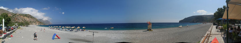
Sougia
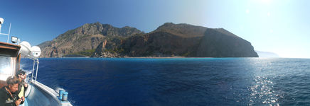
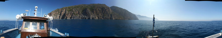
Boat trip to Agia Roumeli
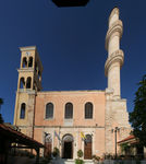
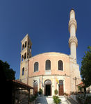
Chania
Psiloritis
The name 'Psiloritis' literally means 'the highest', and refers to both the mountain range
in the center of Crete and its highest point, which is also known as 'Mount Ida' or 'Timios Stavros'.
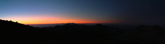
My plan had been to climb the top in the evening and stay there over night, as I did on Pachnes,
but due to the delay I experienced after Samaria Gorge, I car-camped at the trailhead and
started climbing around 4 AM. It turned out that the path was longer than expected and as boring as on Pachnes,
and in order not to risk my flight to Zurich, which was to depart at noon, I decided to take it easy and just
climb a minor summit facing East, such that I still could observe the beautiful sunrise.
| getting there by car in the evening before
| 
| 
|
|---|
| sunrise the next morning
| 
|
|---|
|
![[Valid HTML5]](../../pic/html5.png) URL: http://David.von-Oheimb.de/gallery/Crete/index.html,
Last modified: Sat Jun 2 20:18:25 CEST 2012
URL: http://David.von-Oheimb.de/gallery/Crete/index.html,
Last modified: Sat Jun 2 20:18:25 CEST 2012