I had been planning to climb 'Eldo' at least six times over the last two years, and so far it had not worked out because of bad weather, too much work, or not finding a climbing partner. Yet finally I was lucky: a weekend with stable weather was approaching, and this time I got even two climbing partners, Matt and Jared :-)
We car-camped in order to get an early start at 4 AM. Crossing the stream on a series of conveniently arranged trunks was straightforward, while we occasionally had slight problems finding the trail and staying on it in the dark woods. Later on the talus fields we did not see the cairns but generally found our direction rather easily, with the exception of some bushwhacking which we could have avoided by bearing more to the right towards Eldorado Creek. From then onwards we had enough daylight to see the climbers path easily, but in the following rocky areas there were no markers, such that we got a few hundred feet too high on the rim that needs to be crossed to the left at about 6000 ft before descending some 100 ft into the Eldorado Glacier basin.
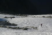
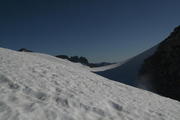
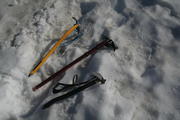
We had to strap on our crampons as soon as we hit snow fields because in the morning their surface was very hard and slippery. On the other hand, the glacier was surprisingly easy to traverse: despite the relatively late season, we encountered only very few open crevasses and did not need to cross any - I was even tempted to go unroped! These exceptionally favorable conditions were due to record snowfalls in the winter before. When approaching the characteristic East Ridge we figured that we could cross through a gap rather than detouring much to the East. Turning west on the East Ridge towards the summit, the snow flanks got relatively steep (up to around 40°) but by then the snow was just soft enough to provide good grip. Then finally came the highlight of the whole climb: the knife-edge snow-covered summit ridge. Having climbed the even more exposed ridge between the Eastern and central summit of Piz Palü a couple of weeks before, it did not really cause me trouble but just an enjoyable slight thrill. Since all of us were in relatively good shape, we took 7 hour for the ascent including breaks and detours due to routefinding problems.
The views from the summit were nearly perfect, with essentially all well-known North Cascades peaks surrounding us relatively close by. Because of the steep route, the descent was rather quick - within an hour we had left the glacier area behind, and within another three hours, again including a break and some time lost in finding the path on the lower talus fields, we were back to the parking lot. Although climbing Eldorado with its 6800 ft elevation gain is considered a brutal day hike, but after doing Glacier a week before, in comparison it was to me almost like a piece of cake. An excellent non-technical workout with great views - certainly one of my favorites!
The photos showing me are courtesy of Matt.
|
| 
Yawning for a reason
| 
| 
| 
|
|---|
|
| 
| 
| 
| 
Johannesburg Mountain
|
|---|
|
| 
| 
| 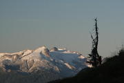
Snowking Mountain
| 
|
|---|
|
| 
| 
Glacier Peak
| 
| 
First sight of the summit
|
|---|
|
| 
Here we were too high on the rim
| 
| 
| 
|
|---|
|
| 
Snowking Mountain
| 
| 
Southern panorama
|
|---|
| Eldorado Glacier
| 
| 
| 
| 
|
|---|

| 
| 
| 
|

| 
| 
| 
|

360° panorama, starting east
|

The characteristic East Ridge
| 
The summit ridge
| 
Note the climbers
| 
|
| The gap
| 
| 
| 
| 
|
|---|
| On the East Ridge
| 
| 
| 
Forbidden Lake
| 
|
|---|

| 
| 
| 
|

| 
| 
The 'knife-edge' summit ridge
| 
|
| On the summit ridge
| 
| 
| 
| 
|
|---|

| 
| 
Mount Rainier
| 
Glacier Peak
|
| On the summit
| 
| 
| 
| 
|
|---|

360° panorama, starting north
|

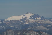
Mount Baker
| 
Mount Shuksan
| 
American Border Peak
| 
Hozomeen Mountain
|

Boston Peak and Sahale Peak
| 
Forbidden Peak and Lake
| 
Forbidden Peak
| 
Snowking Mountain
|
| On the summit ridge
| 
| 
| 
| 
|
|---|
| On the East Ridge
| 
| 
| 
| 
|
|---|
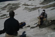
| On Eldorado Glacier
| 
| 
| 
| 
|
|---|
|
| 
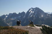
Up the rim
| 
| 
| 
Snowking Mountain
|
|---|
|
| 
Forbidden Peak and Sahale Peak
| 
Forbidden Peak
| 
Sahale Peak
| 
last view of Eldorado
|
|---|
|
| 
Johannesburg Mountain
| 
| 
| 
|
|---|
| Talus fields and forest
| 
| 
| 
| 
|
|---|
| Logs crossing Cascade River
| 
| 
| 
| 
Back at the parking lot
|
|---|
URL: http://David.von-Oheimb.de/gallery/Eldorado/index.html,
Last modified: Mon Sep 29 05:44:47 PDT 2008


